El Caminito del Rey, the most dangerous path in the world
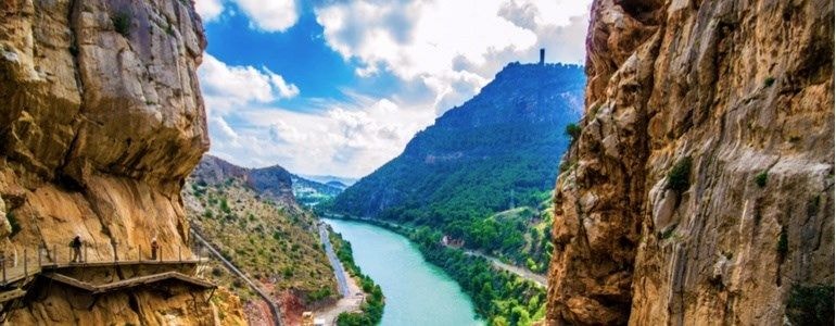
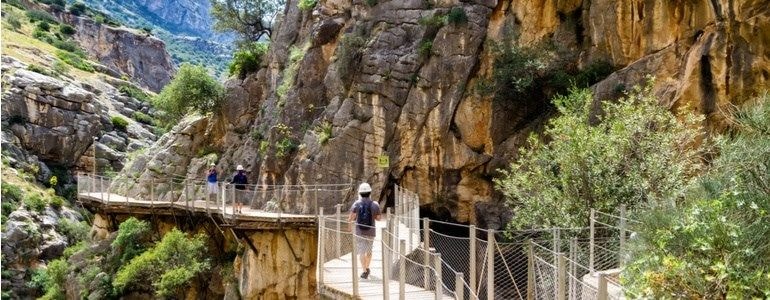
If you are passionate about hiking you may have heard about Caminito del Rey, in Malaga. It is an aerial path built on the walls of the magnificent Gaitanes Gorge, which causes amazement for its construction and for the beauty of the landscape that can be seen from there, in a route of more than three kilometers. In it you can walk an adjacent path with a width , in the most comfortable areas, of no more than one meter.
The path of Caminito del Rey runs through different towns, it begins in Ardales, continuing through Antequera and ends in the town of Álora, on a road with an altitude of 100 meters above the river featuring incredible vertical walls, not suitable for those who are afraid of heights. This was considered for decades as "the most dangerous path in the world", originally built in 1901 by the Hydroelectric Society of El Chorro, to connect the accesses of Salto del Gaitanejo and Salto del Chorro and facilitate the work of the maintenance workers and transportation of materials. From the year 2000 until 2015, it closed its “doors” due to the dangerous nature of its route, although some adventurers continued to sneak in covertly. The path has been reconditioned with wooden boards to make it more walkable; currently entry is allowed to the general public, including children over 8 years.

How to get to the walking route driving your car
The best way to get to Caminito del Rey is driving your rental car from Malaga. You can get to the path driving your car through different roads, depending on your point of departure. If you start in Malaga, you need to arrive via Ardales or Alora driving on the A-357 to MA-4503. If your starting point is Antequera, the best route would be taking the A-92 road, turning later to Campillos towards the Marshes of El Chorro. Finally, you can access Caminito del Rey from Ronda through the A-367, driving to the town of Ardales.
Tips for the path (preparation, itinerary, dates and weather)
The difficulty of Caminito del Rey in Malaga is medium-low, so there are many visitors who tackle it without having an extensive hiking experience, however it is advisable to have some background since it has different hikes, slopes, footbridges and stairs that you will need to deal with at Caminito del Rey.
You will not have to worry about the itinerary since everything is perfectly marked, so you won’t get lost or confused. It is a cold place, so if you take the route during the winter months, wear mountain clothes to keep you warm. The itinerary is eight kilometers long, of which five kilometers are lanes and three kilometers go from footbridge to footbridge, a journey worth enjoying for nature lovers.

Where to make the best photographs on the road
Undoubtedly, the best place to take the customary photo is at the glass-floor observation platform 100 meters above ground. Also, the natural landscape of Los Gaitanes Gorge is a wonderful landscape to be captured in a photo. Other points of interest where you can take good photographs are the Ruins of Bobastro or the Castle of la Estrella.
Caminito del Rey is a unique path that we recommend you to enjoy on your next road trip through Malaga. Remember to bring proper equipment, do the right schedule and enjoy traveling one of the world’s most famous trails.